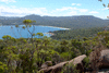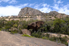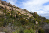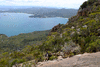
















Tasmania 2013

Visit to Tasmania for the fourth meeting of the lead authors of the IPCC WG1 AR5, and the CLIVAR WGOMD workshop on sea-level rise and ice-sheets.

Images are © Jonathan Gregory 2013.

See also the COMPUTER VERSION of this album.

Each thumbnail image below is a link to its own picture page, on which the caption and navigation are beneath the picture, and the image itself is a link to the next picture. It is sized to fit on a mobile screen expecting that you will set the phone to auto-rotate.

Conclusion of the SPM meeting, Saturday 19th January
f002-0278a Kanikicharla Krishna Kumar and Drew Shindell f002-0290a Nathan Bindoff
f002-0291 David Vaughan f002-0292 Valérie Masson-Delmotte
f002-0293a Pauline Midgley and Melinda Tignor f002-0294 Kasper Plattner, Monika Rhein and Dennis Hartmann
f002-0295a Jerry Meehl, Drew Shindell and Reto Knutti f002-0314 Dennis Hartmann and Reto Knutti
f002-0297 Qin Dahe and Valérie Masson-Delmotte f002-0298 Alex Nauels, Simon Allen and Pauline Midgley
f002-0300a David Wratt and Nathan Bindoff f002-0301a Kanikicharla Krishna Kumar
f002-0305a Dennis Hartmann f002-0307a Jean Jouzel
f002-0308a Kasper Plattner and Simon Allen f002-0309 Jean Jouzel and Thomas Stocker
f002-0316 Thomas Stocker and Jerry Meehl
f002-0311 f002-0312a The Technical Support Unit and the Developed Country Co-chair
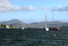
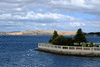
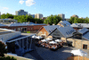
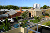
Views of Hobart and its surrouding from the Wrest Point, the venue for the IPCC meeting
f002-0262 f002-0266 f002-0267 f002-0272 f002-0276 f002-0319
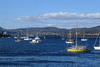
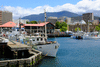
Around Hobart harbour
f002-0258 f002-0259 f002-0433 f002-0435
f002-0509a f002-0508 f002-0492
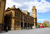
f002-0495 Monument to Tasman f002-0506a Tasmanian Museum
Salamanca Square viewed from John and Majnun's flat
f002-0365 f002-0366
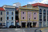
Hobart city centre
f002-0431 f002-0432 f002-0434 f002-0436
f002-0437 f002-0438 f002-0439
Visit to Port Arthur, Sunday 20th January
Organised by John Hunter.
f002-0324
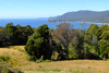
f002-0329 f002-0332 f002-0333 Tessellated Pavement
f002-0334 f002-0336 f002-0337
f002-0341 f002-0343 Tasman's Arch and nearby coastline
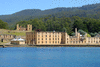
f002-0357 Prison buildings at Port Arthur f002-0356 The Governor's house
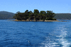
f002-0354 f002-0345 f002-0346 f002-0349 The Isle of the Dead and its famous tidal benchmark
f002-0350 f002-0351 f002-0352
f002-0358 f002-0359 f002-0360 Coastline near Remarkable Cave
f002-0361 f002-0363 f002-0364
Mt Field Park, Australia Day, Saturday 26th January
With Steve.
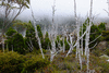
f002-0370 f002-0371 f002-0373 f002-0374 Tarn Shelf track
f002-0377 f002-0379 Climbing up to The Watcher
f002-0380 f002-0382 f002-0384 Views of Mt Field West from the K Col track
f002-0385 Lakes Belcher (nearer) and Belton seen from K Col f002-0386 f002-0387 K Col
f002-0389 f002-0392 Lake Seal f002-0394 Typical woodland view from Lake Dobson
Mt Amos (454 m), on the Freycinet Peninsula, Sunday 27th January
With Steve.
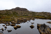
f002-0397 f002-0399 f002-0400 Mt Amos and views of Coles Bay
f002-0401 f002-0410
f002-0409 Near the summit of Mt Amos f002-0406 Wineglass Bay on the L, Hazards Beach on the R
f002-0407 Cape Forestier f002-0413 Sunset over Coles Bay
Mt Graham (579 m), on the Freycinet Peninsula, Monday 28th January
With Steve.

f002-0414 f002-0417 Wineglass Bay beach
f002-0416 f002-0418 The Hazards seen from Wineglass Bay
f002-0419 f002-0421 Ascending Mt Graham
f002-0422 f002-0424 Views from Mt Graham, Hazards Beach on the L, Wineglass Bay and the Hazards on the R
f002-0426 In the forest S of Mt Graham f002-0427 f002-0428 Cooks Beach
f002-0429 Hazards Beach, with Mt Graham and Mt Freycinet behind f002-0430 View to sea from Hazards Beach track
Steve's back garden at Strickland Avenue
f002-0443 Looking down the garden towards Hobart rivulet f002-0441 f002-0490 Mt Wellington
f002-0446 Smoke coming over the mountain from a bushfire at Molesworth, five miles away
Lunch at Zum Cafe, Saturday 9th February
f002-0449 John and Majnun f002-0452 Rohan, their son
f002-0448 Alex, Rohan's partner, and John Gould f002-0451 Hilary Gould
f002-0454 JMG
Mt Anne, Sunday 10th February
With Steve. On the way up the visibility was poor and the weather unpleasant, so the views are all from the descent.
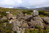
f002-0461 Mt Anne seen from Mt Eliza f002-0459 f002-0460 On Mt Eliza
f002-0457 Lake Pedder f002-0462 Ridge descending Mt Eliza to the hut
f002-0464 Mt Anne seen from the lower slopes f002-0463 Nearly back at the campsite
Views from Edgar Dam
f002-0466 Shore of Edgar Pond f002-0467 f002-0469 Western Arthurs
f002-0465 f002-0470 Mt Anne
Mt Hesperus (1098 m), Monday 11th February
With Steve.
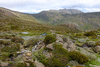
f002-0472 f002-0473 f002-0475 f002-0476 Forest views on MacKay's track from Scott's Peak Dam on Lake Pedder to the Port Davey track
f002-0477 Mt Hayes and Mt Hesperus f002-0478 Fording a river just before the junction with Port Davey track
f002-0479 Mt Hesperus and the Alpha Moraine etc-scroggin Eating scroggin on the summit of Mt Hesperus
f002-0481 View SE along the Western Arthurs ridge from Mt Hesperus, Lake Pluto on the L (half in the picture), Lake Neptune, Lake Triton f002-0483 Lake Fortuna
f002-0484 Descending Mt Hesperus
f002-0485 f002-0486 View back across the forest to Lake Pedder
f002-0487 Mt Anne and Mt Eliza
Hartz Mountain Peak, Sunday 17th February
With Steve, Nathan Bindoff and his son Leo.
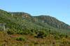
f002-0497 f002-0498 On the way up
f002-0500 f002-0502 Views from the summit
f002-0503 f002-0504 Ladies' Tarn
Sydney, Saturday 23rd February
A day of strong wind and continual heavy showers.
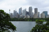
f002-0515 f002-0516 Sydney downtown, Opera House and Harbour Bridge seen from the Botanical Gardens
f002-0519 View from Circular Quay, with the Cunard liner Queen Victoria
f002-0521 f002-0523 f002-0522 f002-0524 Sydney Opera House, Circular Quay, The Rocks (district of old buildings near the waterfront) and the bridge, seen from the observation platform on one of the stone pylons
Coogee Bay, Sydney, Sunday 24th February
The wind was still strong. The orange sign says "Beach closed - dangerous conditions".
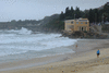
f002-0528a f002-0530