New Zealand 2005

Visit to New Zealand for IPCC WG1 AR4 Third Lead Authors' Meeting in Christchurch, Thursday 8th December 2005 to Saturday 17th

Images are © Jonathan Gregory 2005.

See also the COMPUTER VERSION of this album.

Each thumbnail image below is a link to its own picture page, on which the caption and navigation are beneath the picture, and the image itself is a link to the next picture. It is sized to fit on a mobile screen expecting that you will set the phone to auto-rotate.

Journey inland from Christchurch to Arthur's Pass
Nathan Gillett and I hired a car in Christchurch and drove NW along route 73 to Arthur's Pass village on Thursday 8th.
38-036 38-035 Approaching the Torlesse Range.
38-032 38-031 Crossing the Torlesse Range (hills up to about 2000 m).
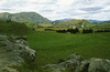
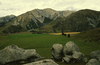
38-030 Castle Hill rocks, a limestone outcrop. 38-029 Prebble Hill (902 m, on the right) and the Craigieburn Range (hills up to about 2000 m, on the left) seen from Castle Hill.
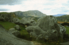
38-028 38-027 Castle Hill rocks. 38-026 Torlesse Range seen from Castle Hill.
38-025 Looking east while crossing the Waimakariri River. 38-024 Looking west while crossing the Waimakariri River, towards Mt Murchison and others (around 2400 m).
38-023 Looking north-east while crossing the Waimakariri River, towards Mt Williams (1716 m) (I think).
Journey from Arthur's Pass to the west coast
We continued westwards, but towards the coast we had heavy rain, so no photos.
38-022 Taramakau River 38-021
Cass Lagoon Saddles Track
A two-day walk, Friday 9th and Saturday 10th, staying overnight at Hamilton Hut.
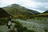
38-020 Joining the Cass River by Romulus, the low hill on the left, looking towards Baldy Hill (1834 m).
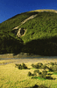
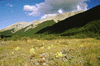
38-019 38-018 38-017 Views while walking up the Cass River.
38-016 38-015
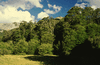
38-014 In the beech forest above the Cass River. 38-013 Crossing the river by the Cass Saddle Hut.
38-012 Unnamed peaks above Cass Saddle. 38-011 View back NE from Cass Saddle.
38-010 38-009 Descending in beech forest towards Hamilton Creek.
38-008 View NE up Hamilton Creek, Cass Saddle at the low point of the skyline and Hamilton Peak on the R. 38-006 Approaching Hamilton Hut, which is in the trees at the end of the clearing.
38-005 Stag Hill above Hamilton Creek, seen from Hamilton Hut.
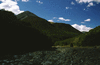
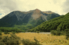
38-004 38-002 Craigieburn Range seen from near Hamilton Hut, Hamilton Peak on the L.
38-007 38-003 38-001 Unnamed peaks (about 1900 m) on the W bank of the Harper River, seen from Hamilton Creek near Hamilton Hut.
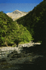
39-037 Saturday morning soon after leaving Hamilton Hut. 39-036 Crossing Hamilton Creek.
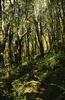
39-034 Crossing Harper River. 39-033 In the beech forest near W Harper Hut.
39-032 39-031 39-030 Views while walking up Harper River.
39-029 39-028 In the beech forest climbing towards Lagoon Saddle.
39-027 View N from Lagoon Saddle. 39-026 Confluence of Bealey River (R) and Waimakariri River seen from Mt Bruce (1630 m), with Bealey Peak and Avalanche Peak between the two rivers.
39-025 Grey Range, seen from Mt Bruce. 39-024 View E along Waimakariri River valley while descending Mt Bruce.
Avalanche Peak (1833 m) above Arthur's Pass, Sunday 11th
39-023 View N along Otira Valley. 39-022 Crow Glacier and Mt Rolleston (2275 m) from Avalanche Peak.
39-021 Nathan on Avalanche Peak.
Christchurch Botanical Gardens, Saturday 17th
39-019 39-018 39-015 39-014
39-016 The base (bottom 20' or so) of the trunk of a colossal eucalyptus. 39-013 Stewartia sinensis.