Each thumbnail image below is a link to its own picture page, and each picture page has a link to the next one.
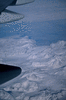
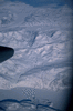
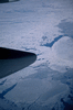
Canada seen from the flight to Los Angeles
Sea-ice.
Big Island Philippe Huybrechts and I stayed in Hilo on the east coast of the Big Island (the island of Hawai`i) from Wednesday 23rd to Sunday 27th, and went on day-trips round the island in a rental car. The Big Island is the easternmost and youngest of the Hawaiian islands. It's less than 100 miles across.
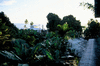
View from the deck of the Wild Ginger Inn.
Our hire car (a free upgrade from a less sporty model).
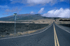
View inland from the Belt Road between Hilo and the Volcanoes National Park in the south of the island.
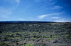
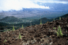
Countryside near the Volcanoes National Park, with Mauna Loa behind, showing the effect of fencing out feral animals.
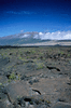
`A`a lava of different ages. It turns red from black with age.
Volcanoes National Park, Thursday 24th February Kilauea (altitude 4078') is the youngest and currently most active volcano on Hawai`a, following Mauna Loa.
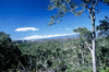
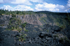
Kilauea Caldera from Sulphur Banks.
Kilauea Caldera and Mauna Loa, with snow on the summit.
`Ohi`a lehua (Metrosideros polymorpha), the most abundant and widespread tree in Hawaii, which grows with variable habits, including as a small bush like this.
Philippe at Sulphur Banks.
Sulphur Banks.
Sulphur crystallising from emerging vapour.
Kilauea Caldera from Crater Rim Drive, with Halema`uma`u Crater in the distance on the left and `ohi`a in the foreground.
Halema`uma`u within Kilauea Caldera from Kilauea Overlook. Halema`uma`u is the most recently active part of the caldera, and contained a lava lake from 1905 until a phreatic explosion in 1924, since when it has been filling in.
Halema`uma`u from the Jaggar Museum on Crater Rim Drive.
Kilauea Caldera rim.
A recently opened fault on Crater Rim Drive.
Crater Rim Drive.
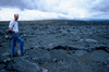
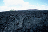
Recent lava outflows. This is pahoehoe, basaltic lava that has a smooth, hummocky, or ropy surface.
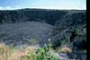
Keanakakoi Crater, near Crater Rim Drive.
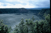
Kilauea Iki Crater, adjacent to the main Kilauea Caldera.
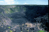
Pauahi Crater, on Chain of Craters Road leading down to the sea.
Pauahi Crater.
Lava flow obstructing the road to Pu`u Huluhulu (left) and Mauna Ulu (3480', right). This is `a`a, lava with a rough rubbly surface composed of broken blocks. The transition from pahoehoe to `a`a is favoured by high viscosity from cooling or outgassing; the chemical composition is the same.
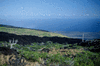
View to the coastal plain and the ocean, with a band of `A`a in the foreground, from Chain of Craters Road before descending Holei Pali escarpment.
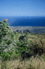
View of the the coastal plain and the ocean.
End of the road, where it was blocked by lava flows from Pu`u `O`o vent.
Steam arising from lava reaching the ocean along the coast.
Pahoehoe on the coastal plain, Holei Pali escarpment behind.
Lava on the hillside after dark.
Mauna Loa and Mauna Kea, Friday 25th February We drove from Hilo along the Saddle Road to its summit, then first south to the Mauna Loa NOAA observatory, and north to Mauna Kea. Philippe drove to the summit of Mauna Kea, where the observatories are located.
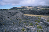
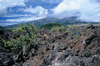
Incipient vegetation invading `a`a flows, with cinder cones behind.
Summit of the Saddle Road across Hawaii, looking towards Mauna Kea, with Mauna Loa at your back.
Vegetation invading pahoehoe, probably early 20th-century, with Mauna Loa (13677') behind.
Mauna Kea (13796').
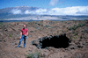
Philippe next to a lava tube, with Mauna Kea behind.
At the NOAA laboratory which is the source of the longest continuous record of measured CO2 concentrations, starting in 1955.
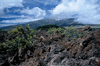
Vegetation on `a`a. The green hill behind is a nature reserve, which has been fenced to keep out feral animals.
(Same picture with a smaller aperture)
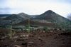
Cinder cones near the Onizuka Visitor Center on the slope of Mauna Kea.
Clouds over `a`a.
Return along the Saddle Road.
South and west coasts, Saturday 26th February We drove from Hilo south-west to the coast, followed the west coast to the northernmost point, then returned along the Kohala Mountain ridge and the Saddle Road across the interior.
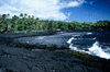
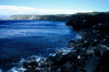
Punalu`u Harbor, on the south-east coast.
View west along the coast from Ka Lae, the southernmost point of the Big Island.
The royal enclosure at Pu`uhonua o Honaunau National Historical Park.
A green sea-turtle.
Near the beach in the place of refuge (pu`uhonua), looking inland towards the Great Wall and the royal enclosure behind. White pebbles come from coral and black from lava.
View east along the coast at `Upolu Point, the northernmost point of the island.
Kamehameha the Great was the first king of the entire Big Island, from 1791, and from 1810 was king of all of the islands. Mookini Heiau is a temple.
Mookini Heiau, one of the oldest on Hawaii, perhaps 5th-century.
Sunset over the Pacific seen from Mookini Heiau.
North-east coast, Sunday 27th February A morning excursion from Hilo along the coast and back.
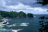
Finger of lava jutting out into the sea, viewed from the Pepe`ekeo Scenic Drive.
African tulip trees.
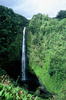
`Akaka Falls (420' feet high).
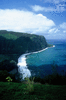
Waipi`o Bay.
Walk to Tantalus Peak and Manoa Falls from Waikiki, Monday 28th February The meeting took place at the University of Hawaii and we stayed at the New Otani Beach Hotel at Waikiki, Honolulu, on O`ahu island. I went on this walk the day before the meeting. O`ahu is about 250 miles north-west of the Big Island.
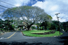
Earpod tree (Enterolobium contortisiliquum, native to Brazil).
African tulip tree (Spathodea companulata, native to western Kenya and Uganda, common in Hawaii).
Bamboo plantation.
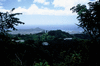
View of Honolulu from the slopes of Tantalus Peak. The crater is Diamond Head, which is next to Waikiki.
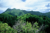
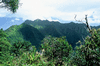
View inland from Tantalus Peak. This landscape is volcanic but deeply incised by rivers, since O`ahu's volcanoes became largely extinct about 2 Myr ago. The vegetation is not native.
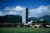
Tantalus Peak (2013') is the hill on the left of the tall building.